Four Easy Hikes in Zagori (Northern Greece)

Zagori has a reputation for being a serious hiking region — and it is. The full traverse of the Vikos Gorge is a 14 km, 6-hour, 900 m descent-and-climb that tests genuinely fit walkers. The loop around Mount Astraka above Papingo is a two-day affair with a high-altitude refuge. We did none of these.
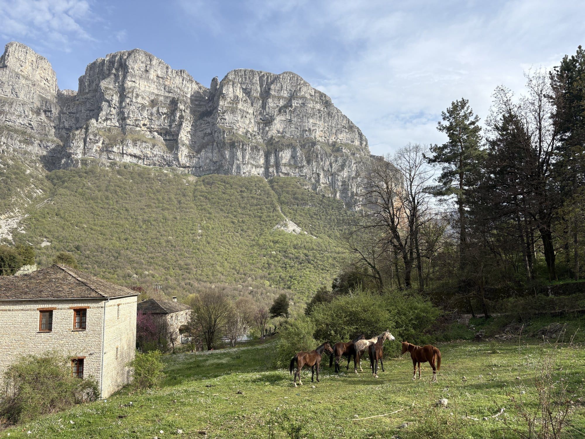
What we did do — with a family group that included a 71-year-old, two kids, and a walker on a recently-operated knee — were four short, entirely manageable hikes. Each is under two hours, each has a proper payoff (view, water, or stones), and each can be done in light trainers without poles. These are the four we would recommend to any first-time Zagori visitor who wants to walk without committing to an expedition.
Bookings: Some links are affiliate links. If you book through them, we receive a small commission at no cost to you.
1. Beloi Viewpoint (from Vradeto) — 1h30 round trip
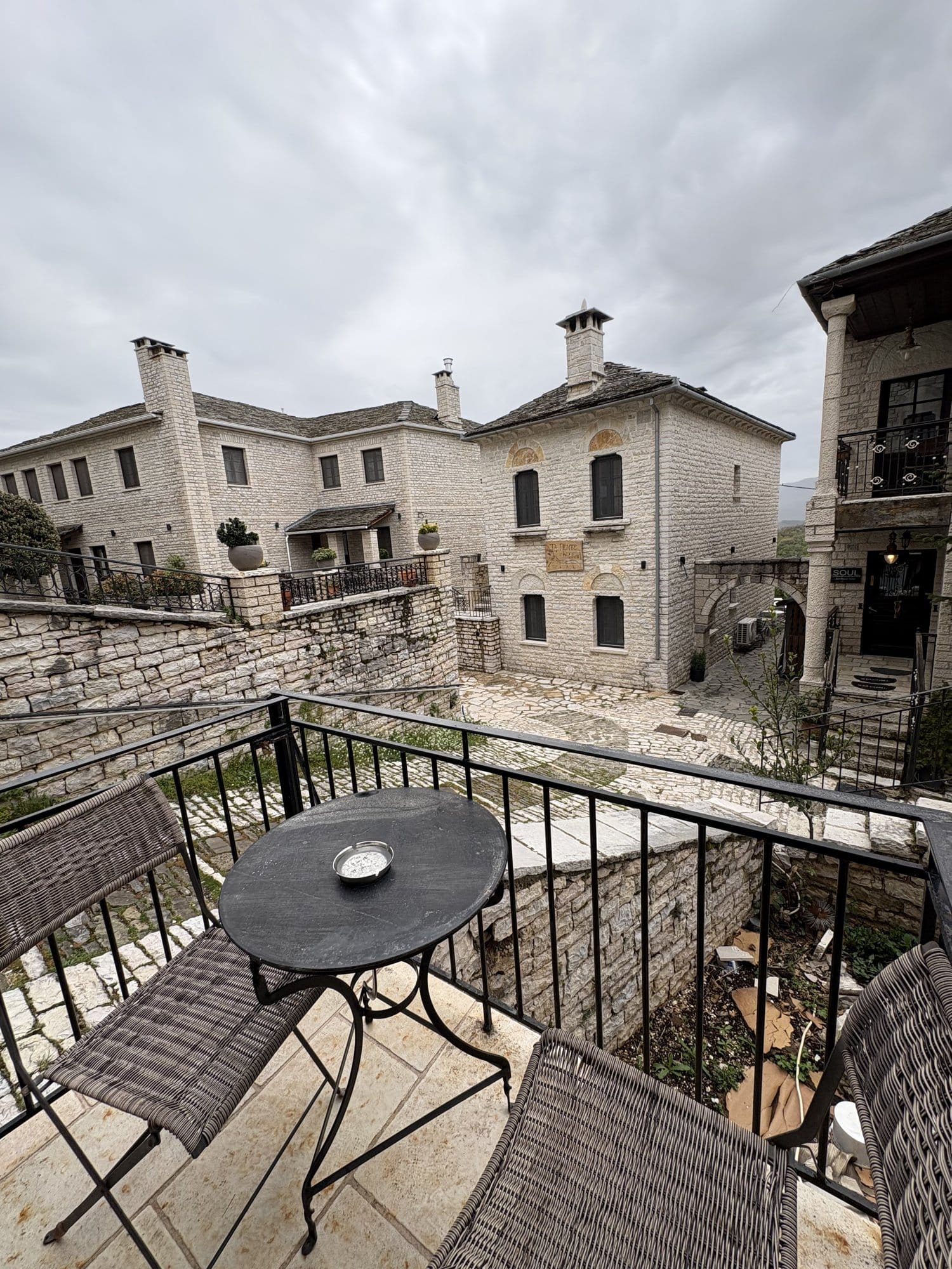
On the map below, we've anchored between Monodendri and Vradeto — the right corner of Zagori for the four easy hikes (Beloi viewpoint, Stone Forest, Vikos start, Voidomatis river). Monodendri itself has the densest cluster of guesthouses with breakfast included; the Papingo villages further north are equally beautiful but reroute every drive over the gorge.
Start: Vradeto village square, roughly 40 min drive from Monodendri. Distance: 2.8 km round trip. Elevation gain: 60 m. Time: 1h to 1h30 depending on how many photos you take. Difficulty: Easy. One gentle uphill on the way back. Kids: Yes, from about age 7. Keep them on the path near the viewpoint — no railings. — full Vikos Gorge hike guide
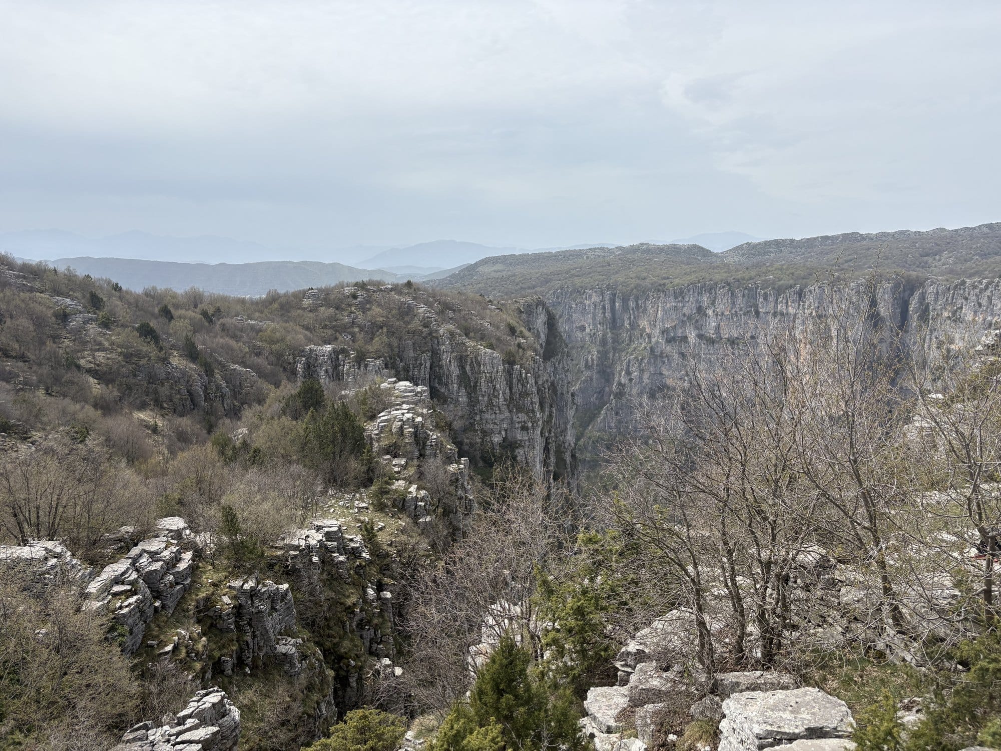
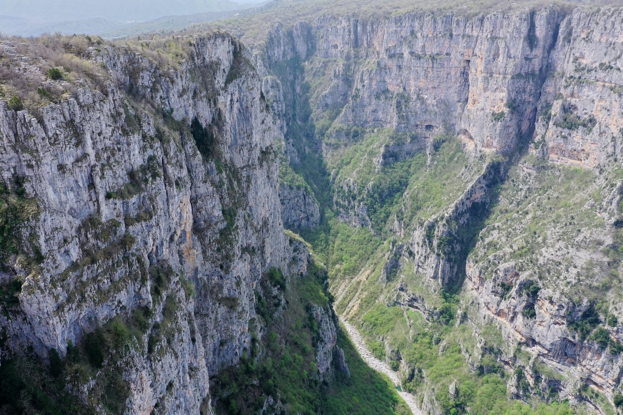
The Beloi trail is, in our view, the single best walk in Zagori. It crosses a small sheep plateau, descends gently towards a rocky promontory, and ends at an exposed stone platform with a 1,000 m drop into the Vikos Gorge below. On a clear day you see the opposite wall of the gorge, the Vikos village on the rim, Mount Gamila and the Astraka towers on the horizon.
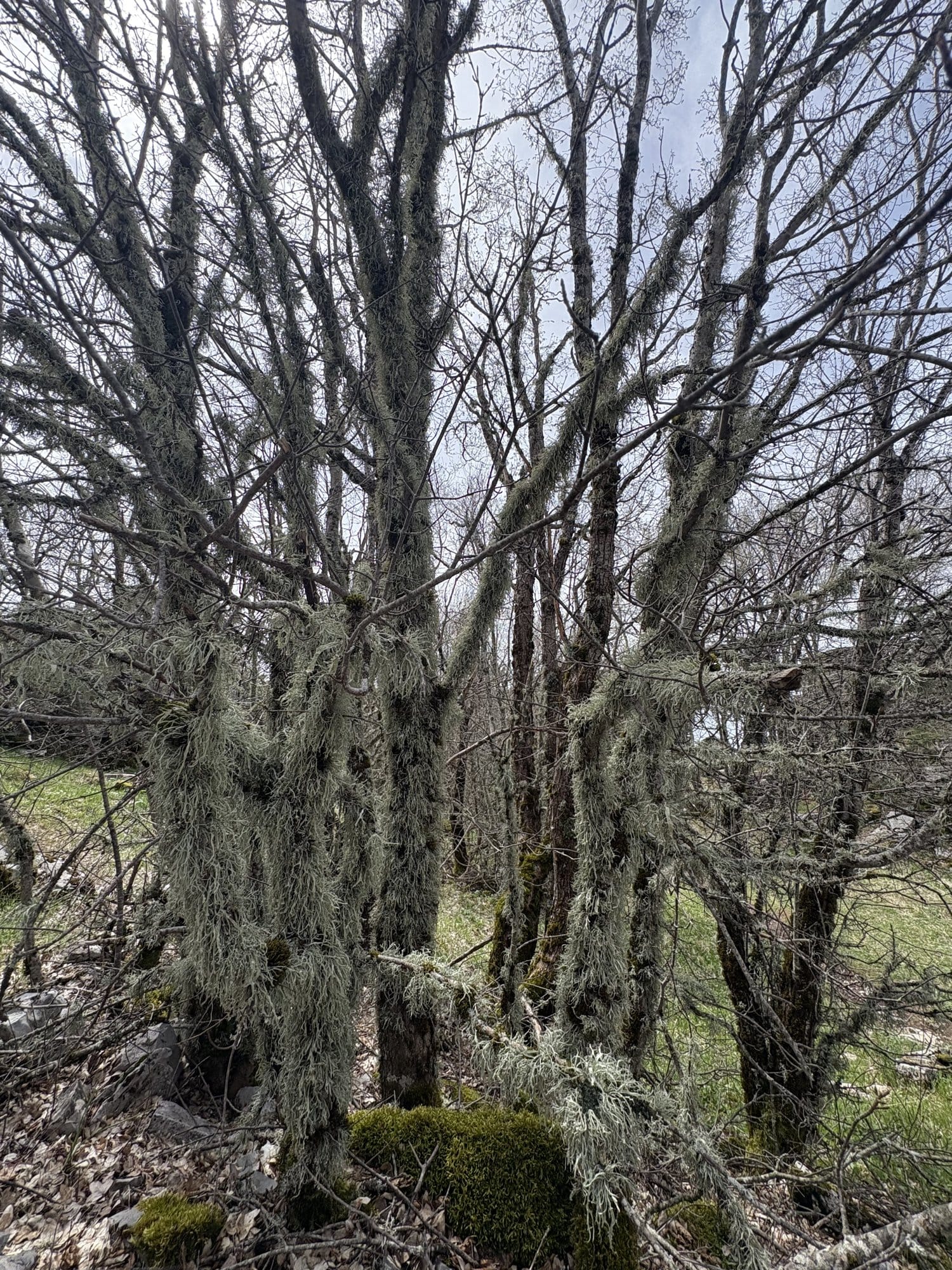
The trail is marked in red paint on rocks from the moment you leave the village. Follow it across a small stream (dry in April) and through a rough alpine meadow. There are no exposed sections until the very end — the last 15 m to the viewpoint — where the rock drops away vertically. Come no closer than three metres from the edge; the stone is brittle and undercut.
Water and wind: bring a windproof layer even in April. The platform is entirely exposed and the up-canyon wind at the edge can be sharp.
Book the 3-hour Beloi viewpoint hike with a local guide
2. Papingo Rock Pools (Kolymbithres) — 1h round trip

Start: Mikro Papingo village, a 1h drive from Monodendri via a spectacular switchback. Distance: 1.8 km round trip. Elevation loss then gain: 80 m down, 80 m back up. Time: 30 min out, 15 min at the pools, 30 min back. Difficulty: Easy-moderate. The descent is on rough rocks; the return climb is tiring for older walkers. Kids: Yes, from about age 7. The final pool scramble is a small adventure.
The Kolymbithres are a chain of three natural stone bowls carved by a small stream into a smooth white schist bed. The path leaves Mikro Papingo from the main square, passes a small chapel, and drops in switchbacks for about 15 minutes down to a stream bed. Follow the stream 200 m upstream and you reach the first pool. The second pool is 100 m further; the third, the largest and deepest, another 80 m beyond.
In April the water was around 7°C — not swimming weather. Most of us just sat on the warm stones with our feet in. By July the water is said to be reasonable if bracing.
The return climb is the hardest part of the walk. Take your time; there is no rush, and the cafe in Mikro Papingo square rewards the effort.
3. Agia Paraskevi Monastery (from Monodendri) — 45 min round trip
Start: Monodendri village, end of the main street. Distance: 1.2 km round trip. Elevation: Flat, paved path. Time: 15 min out, 15 min at the monastery, 15 min back. Difficulty: Very easy. Paved. Kids: Yes, any age. Wheelchair-friendly for the first 600 m; the final approach has a short cobblestone section.
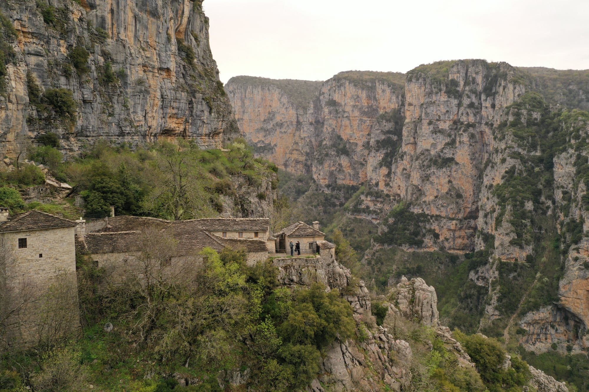
The walk to Agia Paraskevi is as much of a formality as a hike — 15 minutes on a flat paved path through oak forest — but the ending is one of the most striking moments in all of Zagori. The path ends at a small 15th-century monastery built on a narrow rock ledge at the top of the Vikos Gorge wall. From the terrace behind the monastery, you look straight down 900 m into the gorge itself. There is a low stone parapet. It is entirely safe.
For the fit and adventurous, a narrow ledge path continues from the monastery along the cliff face for another 800 m, dropping about 40 m below the rim. We walked it for 10 minutes and turned back — one of us did not like the exposure. It is not a walk for children, and anyone with vertigo should stop at the monastery.
Agia Paraskevi is open during daylight hours in summer; in April it was locked when we arrived in the late afternoon, but the terrace is accessible anytime.
4. Kokkori Bridge and Plakidas Bridge — 40 min combined

Start: Roadside pull-in on the Dilofo-Kipoi road, 15 min drive from Monodendri. Distance: 400 m round trip for Kokkori; 300 m for Plakidas (separate stops 3 km apart). Elevation: Trivial. Time: 20 min each bridge. Difficulty: Very easy. Flat gravel paths. Kids: Yes. Both bridges are a favourite with younger children.
Zagori has around 40 old stone arched bridges — built by 18th-century Epirot merchants to tame the mountain streams on their trade routes. The two most photographed, Kokkori and Plakidas, are both visible from the road but both worth the short walk down.
Kokkori (also known as Noutsos) is a three-arch bridge over a tributary of the Voidomatis. Plakidas is a more compact single-arch bridge over a similar stream 3 km away. Both have small gravel paths leading down to the stream bed; Plakidas even has stepping stones across.
Time each one for late afternoon — the low sun catches the stone arches and makes for the best photograph. If you have older children, the stones around the stream are a natural invitation for an hour of throwing pebbles and building dams.
Can I Do All Four in One Day?
Yes, with tight timing. Here is the day:
- 08:30 leave Monodendri for the Agia Paraskevi monastery (45 min round trip). - 09:30 drive 45 min to Vradeto for Beloi (1h30 walk + driving). - 12:00 lunch at Vradeto or Tsepelovo. - 13:30 drive to Kokkori and Plakidas bridges (40 min). - 15:00 drive 1h to Mikro Papingo. - 16:00 Rock pools (1h walk). - 17:30 coffee and cake at Mikro Papingo square. - 18:30 drive back to Monodendri (or stay in Papingo for the second night).
This is a full day with about 2h45 of driving. We would not recommend it if you have small children — the drives add stress. A more relaxed version splits it over two days, with Beloi plus Kokkori/Plakidas on day one and Rock Pools plus Agia Paraskevi on day two.
What to Wear and Bring
Zagori is a mountain area with fast-changing weather. For these easy hikes in April:
- Shoes: Trail runners or light hiking boots. Trainers are fine but can slip on wet stone. - Layers: A windproof shell is the one essential. Temperatures can drop five degrees between a valley and a viewpoint. - Water: Bring 1 litre per person. None of the walks have drinkable water en route. - Snack: Bakery pies from Monodendri or Kipoi travel well. - Camera/phone: Obviously. The light is best between 08:00-10:00 and 17:00-sunset. - A small first-aid kit in the car — not in the rucksack. The walks do not warrant it, but a stone slip at the rock pools is the one plausible minor injury.
Compare Zagori stone guesthouses
Do I Need a Guide?
No. All four walks are well-marked, well-travelled, and low-risk. Local guides do exist (a half-day hike runs 30-50€ per person) and are worth it if you want local history along the way — the stone bridges are fascinating once you know why they were built where they are. For the walks themselves, no guide is needed.
Book the easy Voidomatis river rafting experience (family-friendly)
Or book a Zagori jeep tour from Ioannina if you prefer no walking
Making Connections
If "easy hikes with a proper view" is the category you are after, our guides to the Dolomites and to Belle-Île cover the same idea in entirely different landscapes. — Northern Greece 11-day road trip itinerary
Getting there
Zagori's stone villages cling to the Pindus mountains in Greece's north-west, three to four hours by car from either Thessaloniki (SKG) or Ioannina airport (IOA). SKG has more international connections; we usually fly there, pick up the rental, and detour through Meteora on the way. — renting a car in northern Greece
FAQ
Which hike is best if I can only do one? Beloi. The view is exceptional and the walking is short.
Are the trails marked? Yes, all four are on the official Zagori walking network and are well-waymarked.
Are the hikes suitable for small children? The Rock Pools and the bridges yes; Beloi from about age 7; Agia Paraskevi even for toddlers.
Do I need a permit? No. All four are free and open year-round.
Which month is best? Late April to early June, and mid-September to mid-October. July-August is hot at lower elevations; winter can close the Papingo road.