
The Karakoram Highway: Ghez Canyon, Karakul and Tashkurgan
From Kashgar at 1,300 metres to Karakul Lake at 3,650, under a 7,509-metre peak — the red walls of the Ghez canyon, the braided rivers of Tashkurgan, and what it takes to get there.

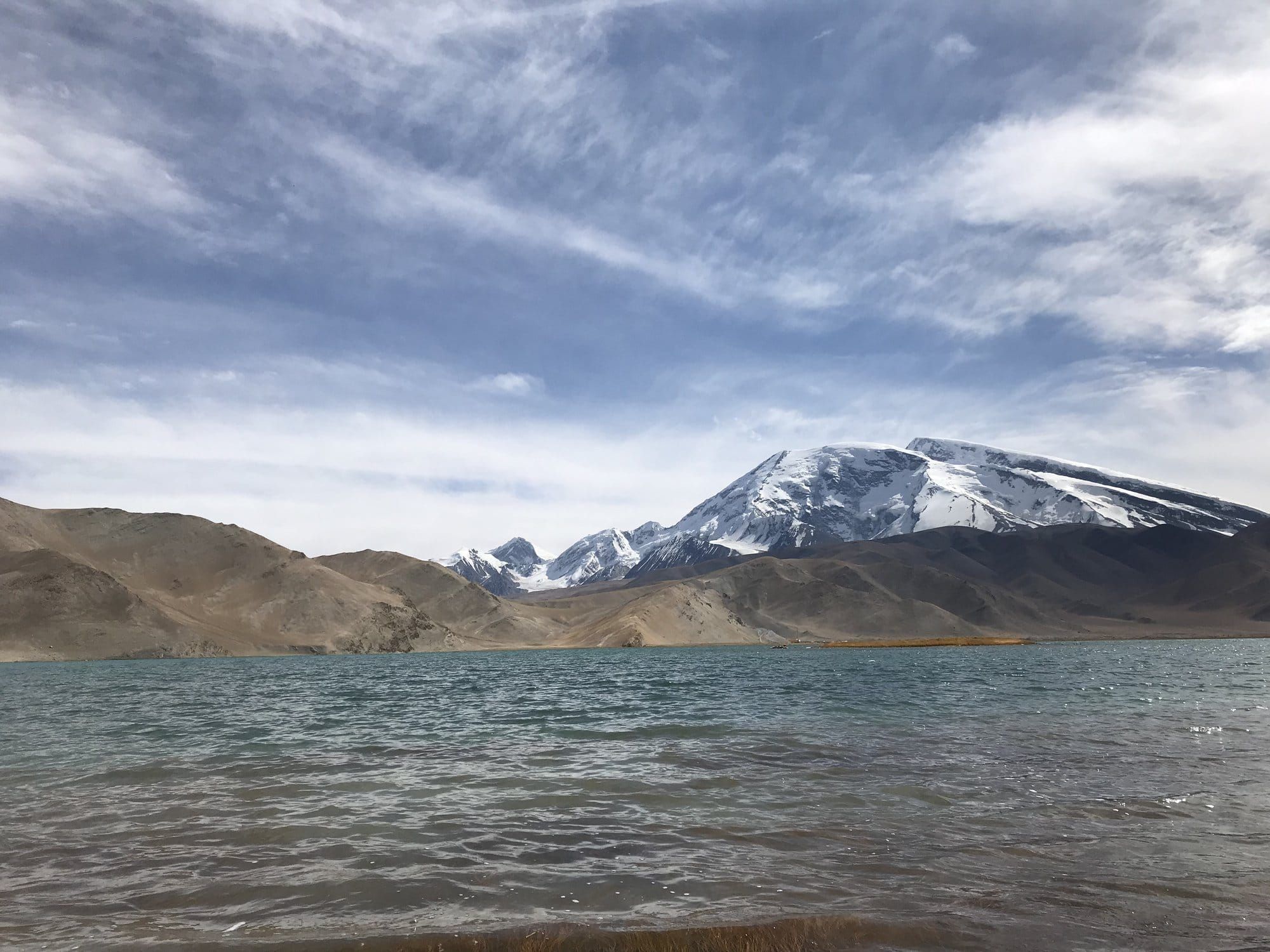
Of the nine days we spent travelling west along the old Silk Road, this is the one the four of us still talk about. One road, one very long day, and a climb of more than two thousand metres between breakfast and mid-afternoon. The desert stops, the rock turns red, and then you are on the Pamir plateau with a snow peak standing in the water.
It is also the stage with the most rules attached to it. Everything from the Ghez canyon upwards sits inside a border zone.
The Climb, Metre by Metre
We left Kashgar early, at around 1,300 metres, with a guide who had been with us every day of the trip. The plain runs on longer than you expect. Poplars, irrigation channels, dust, a roadside stall where the boys were handed warm flatbread through a car window, a bottle of local cola in blue glass. By the time the road commits to the mountains you are only at about 1,420 metres and the sky is still desert-coloured. Then the valley narrows, and the day changes entirely.
Here is the profile, taken from our own GPS traces:
| Point | Altitude |
|---|---|
| Kashgar | ~1,300 m |
| Karakoram Highway, southern exit from the plain | ~1,420 m |
| **Ghez canyon** | ~1,740 m |
| **Baisha Lake** | ~3,210 m |
| **Karakul Lake** | **3,650 m** |
| **Tashkurgan** | ~3,100 m |
Some 2,300 metres of gain, most of it between the canyon and the lake.
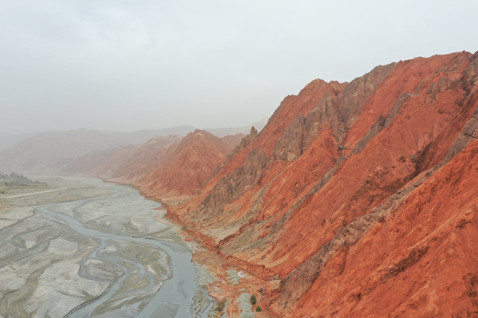
Ghez Canyon
The Ghez gorge is the moment the trip stops looking like anywhere else. The walls are a saturated orange-red, and they drop straight onto a braided riverbed of pale grey gravel, wide and shallow and threaded with a dozen channels. There is usually dust in the air, so the far end of the canyon fades to haze and you lose all sense of how deep it goes.
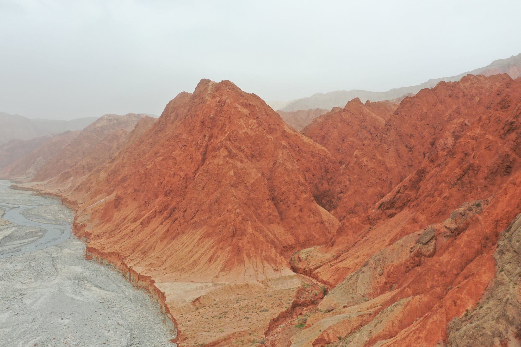
At around 1,740 metres this is not yet high country — it is the doorway. The road follows the river with rock on one side and drop on the other, and you climb steadily without quite noticing.
Baisha Lake and the Plateau
Above the canyon the landscape empties out. Grey and beige scree, no trees, and then Baisha Lake at about 3,210 metres: turquoise water with the road curling along its shore and sand piled against the mountains behind. The colour is startling after two hours of red rock and grey gravel.
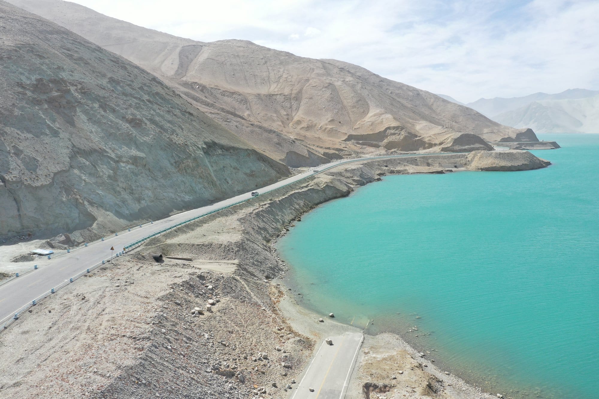
This is also where you notice the air. People in the lay-bys are moving slowly and nobody is in a hurry. That is not atmosphere, it is altitude.
Karakul at 3,650 Metres
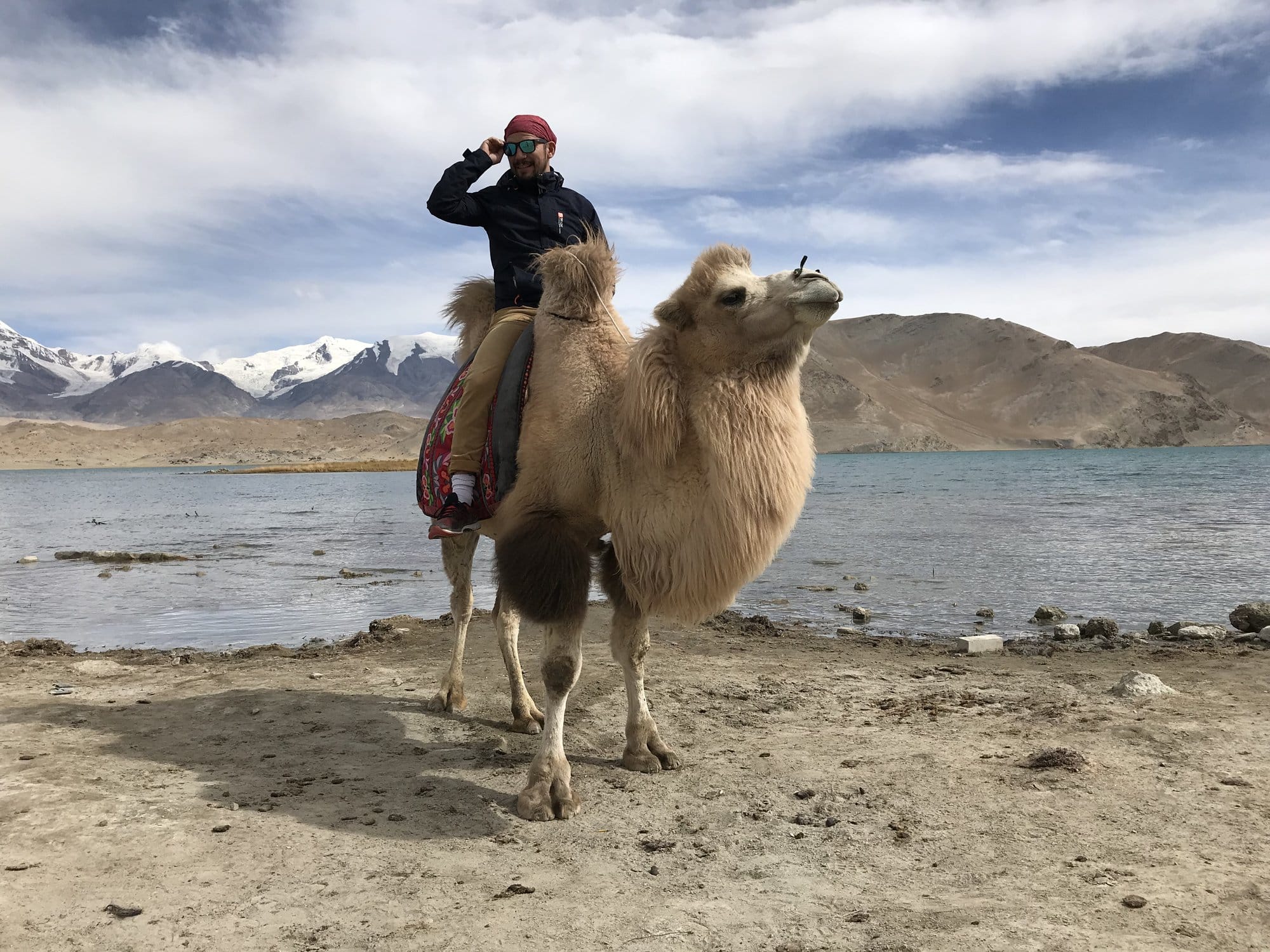
Karakul is the picture at the top of this article, and the reason to make the drive.
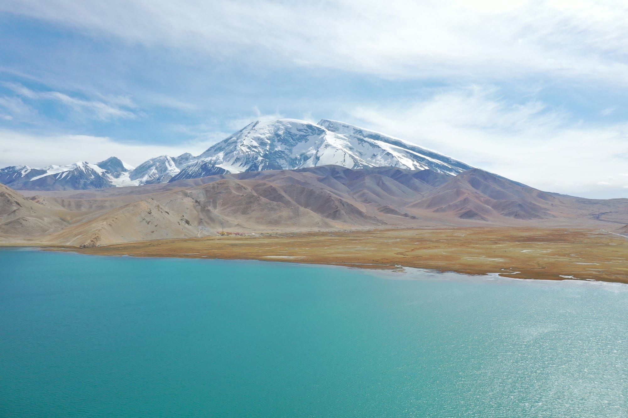
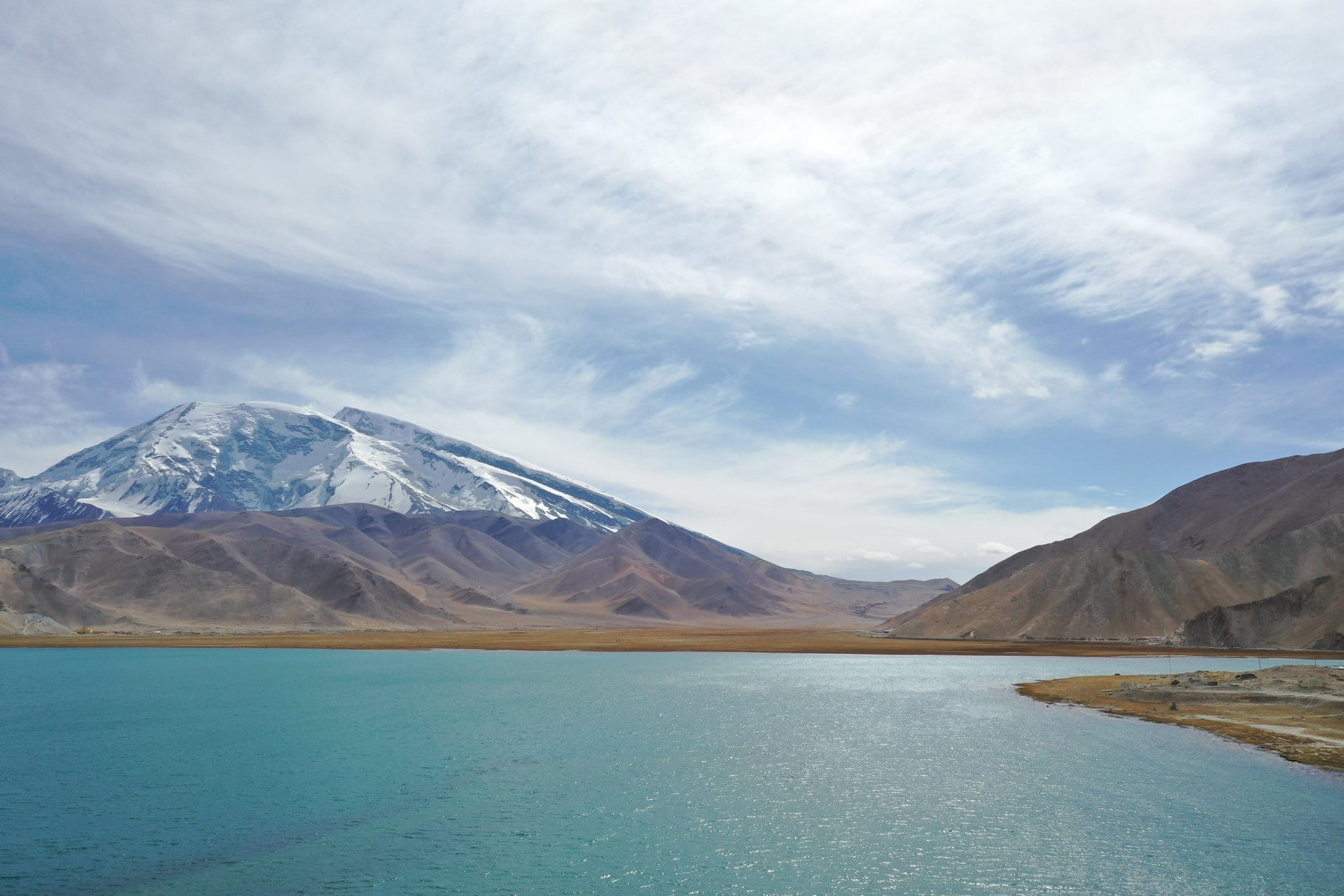
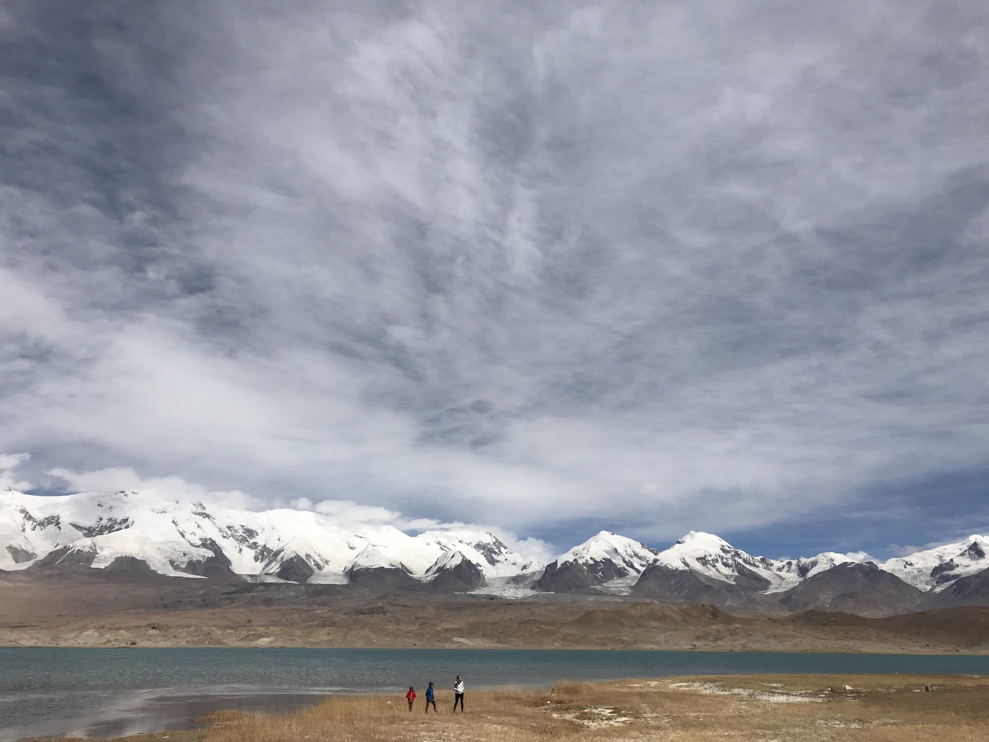
The lake sits at 3,650 metres on an ochre plain, the water a hard turquoise that shifts with the cloud. Behind it, Muztagh Ata rises to 7,509 metres, snow-covered down to the shoulder, big enough that it refuses to look as far away as it is. Bactrian camels graze at the water's edge, shaggy and unbothered. The wind crosses the lake in bands and the surface goes from glass to chop and back in minutes.

We spent the middle of the day there and did almost nothing, which turned out to be exactly right. A short walk along the shore at 3,650 metres, after a morning that started below 1,400, is enough for a first afternoon. Our two boys, then nine and six, were fine — partly because we let them be slow.
Tashkurgan and the Thin Part of the Map
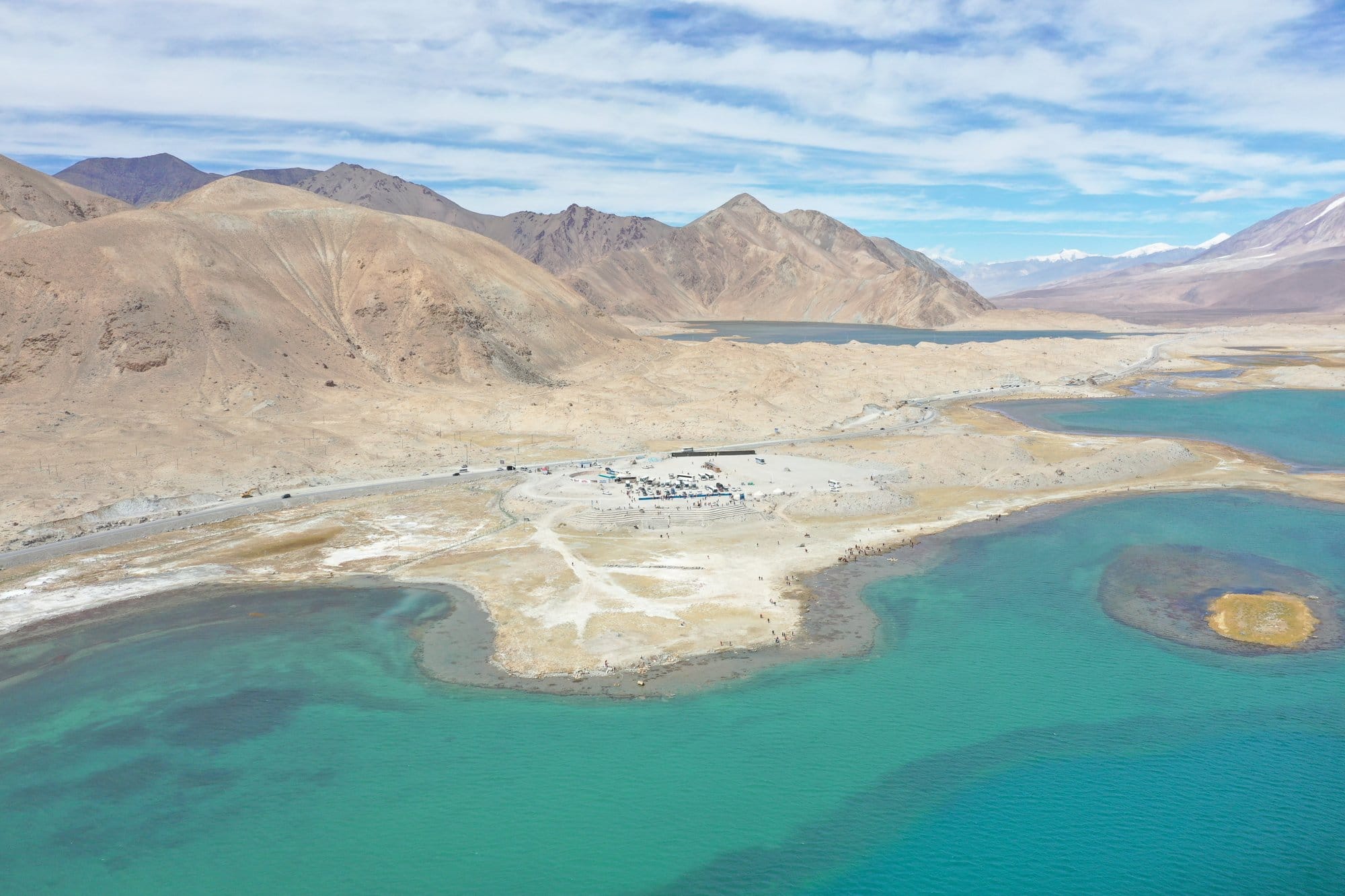
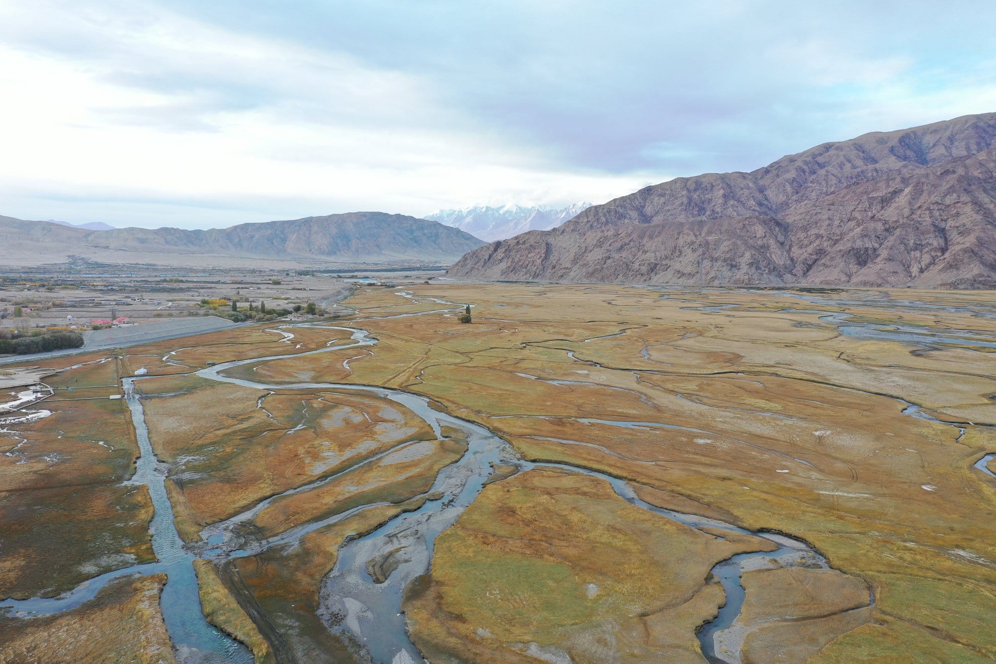
Further south the road drops slightly, to around 3,100 metres, and opens into the Tashkurgan valley. This is a different kind of beautiful: a broad alluvial plain where rivers braid and re-braid across golden grass between two mountain ranges, so wide that the scale only registers when you notice how small the vehicles on the far side look.
Tashkurgan is close to both the Tajik and Pakistani borders, and you feel it — in the signage, in the traffic, and in the number of times documents come out. The Khunjerab Pass crossing into Pakistan runs from here. It is seasonal and politically sensitive, and its status is not something to take on trust from any article, including this one. If a crossing is part of your plan rather than a piece of scenery, verify it directly and recently.
We drove back to Kashgar the same day. It was worth it, but it was long. If your agency can build in a night at altitude, take it.
Getting There: The Part That Needs Planning
This is a border zone, and that governs everything. The Karakoram Highway above the plain, Karakul and Tashkurgan are not places you drive to on a whim with a rental car and a hotel booking. Access runs through a licensed travel agency rather than an independent arrangement, and a pass may be required on top of your Chinese visa. The French foreign ministry states it plainly: "access to border areas may require the obtaining of a laissez-passer."
What we will not do is give you a price or a lead time. The sources available on permit costs and processing delays date from 2019 to 2023 and contradict one another, and a wrong number is worse than none. Confirm the current requirements with a licensed agency shortly before you travel, and check your own government's advice at the same time. These rules change without notice.
A few things are stable enough to be useful:
- A guide is not optional here in practice. Ours spent the day on paperwork and queues, not commentary. - Expect frequent checks. Documents come out repeatedly between Kashgar and Tashkurgan. Carry your passport on you, not in a bag in the boot. - Do not photograph checkpoints, security installations or personnel. This is stated in both UK and French travel advice. - Accommodation is restricted. Not every hotel may take foreign guests, another reason the agency handles bookings.
Context worth knowing before you book. Xinjiang is the subject of documented human rights concerns, including a 2022 assessment by the UN Human Rights Office, and travellers will encounter frequent checks and a visible security presence throughout the region. We have set out what this means in practice, with the official sources, in a separate article.
→ What to know before travelling to Xinjiang
Altitude, With Children
The profile on this stage is aggressive: roughly 1,300 metres to 3,650 metres in a single morning.
Nothing earlier in the trip helps. We had come from Turpan, which lies below sea level, and from Kashgar at around 1,300 metres. That is not acclimatisation in any meaningful sense: you go straight from low ground to high plateau.
What worked for us:
- Plan a slow first afternoon at the lake, not a walk. Sit, look, let children set the pace. The shoreline is flat and that is enough. - Drink far more water than feels necessary, and eat something before the last hour of the climb. - Watch for headache, nausea and unusual tiredness, in children as much as adults, and tell your guide at once. Going down is the fix, and on this road down is straightforward. - Speak to a doctor before the trip if anyone in the group has a heart or lung condition. That conversation belongs with a medical professional, not a travel blog.
For how children handle a full day of effort at altitude, our Tiger Leaping Gorge with kids write-up covers the same question from the other side of China, on foot — and Lijiang and Shangri-La covers a gentler plateau if you are weighing up which high-altitude trip to do first.
A Note on Photographs
The aerial images from this stage are the best of the trip — the red walls of Ghez, the road bending along Baisha Lake, Karakul under Muztagh Ata, the braided rivers at Tashkurgan. They were taken with a DJI Mavic 2 Pro.
Say that with a large caveat attached. Drone flight in China is regulated, and a border zone is precisely the wrong place to make assumptions about what is permitted. Nothing here should be read as a suggestion that you can or should fly. If a drone matters to your plans, raise it with your agency well in advance and accept the answer you get.
When to Go
Late September and early October gave us gold grass at Tashkurgan, dry roads and clear mornings — close to ideal. Winter affects the high sections of the road; summer is the busiest and, down in the desert, brutal.
The one thing we would change: we travelled during the National Day holiday at the start of October, when domestic travel peaks. Shift a few days either side if your dates allow.
Full planning for the wider trip is in our Silk Road China itinerary, which covers how this drive fits with Dunhuang, Turpan and Kashgar.
Frequently Asked Questions
Do you need a permit for the Karakoram Highway in China?
The Chinese section of the Karakoram Highway, along with Karakul Lake and Tashkurgan, lies inside a border zone, so access is arranged through a licensed travel agency rather than booked independently. A pass may be required in addition to a Chinese visa — the French foreign ministry states that access to border areas may require obtaining a laissez-passer. Requirements and paperwork change without notice, so confirm the current position with an agency and with your own government's travel advice shortly before you go.
How high is Karakul Lake, and is the altitude difficult?
Karakul Lake sits at 3,650 metres on the Pamir plateau in western China, and the road reaches it from Kashgar at around 1,300 metres in a single morning. That rate of gain is fast enough to be felt, even by people who are generally comfortable at altitude. Plan a slow first afternoon by the water rather than a hike, drink plenty, and anyone with a heart or lung condition should take medical advice before travelling.
How long does the drive from Kashgar to Tashkurgan take?
We did Kashgar to Tashkurgan and back in one very long day, stopping at the Ghez canyon, Baisha Lake and Karakul along the way. It is comfortably a full day in each direction once checkpoints, photo stops and the climb are accounted for. Adding a night at altitude, at the lake or in Tashkurgan, makes the trip far less tiring.
What is the mountain above Karakul Lake?
The peak that dominates Karakul Lake is Muztagh Ata, which rises to 7,509 metres and is snow-covered down to the shoulder for most of the year. It stands close enough to the lake that it fills the skyline and appears in almost every photograph taken from the shore.
Can you cross into Pakistan at Khunjerab from Tashkurgan?
The Khunjerab Pass crossing between China and Pakistan runs south from Tashkurgan. It is seasonal and politically sensitive, and its opening status and entry requirements vary. Anyone planning to cross rather than simply drive to Tashkurgan should verify the current position with the relevant embassies and a licensed agency immediately before travelling.
Is the Karakoram Highway suitable for young children?
Our two boys were nine and six when we made the drive and managed it well, so the main constraints are altitude and time in the car rather than difficulty. The stops are short, the scenery changes constantly, and nothing requires walking. Build in a slow afternoon at Karakul instead of an activity, and expect children to be included in document checks.
More to Explore
- Silk Road China: A 9-Day Itinerary from Dunhuang to the Pamirs - Kashgar: old town, bazaars and the Sunday livestock market - What to know before travelling to Xinjiang - Tiger Leaping Gorge with Kids